Arrondissement Pointe-à-Pitre
| Arrondissement Pointe-à-Pitre | |
|---|---|
| Geografie | |
 | |
| Hlavní město | Pointe-à-Pitre |
| Souřadnice | 16°14′15″ s. š., 61°31′51″ z. d. |
| Rozloha | 767,81 km² |
| Geodata (OSM) | OSM, WMF |
| Obyvatelstvo | |
| Počet obyvatel | 211 490 (2012) |
| Hustota zalidnění | 275,4 obyv./km² |
| Správa regionu | |
| Stát | |
| Region | Guadeloupe |
| Departement | Guadeloupe |
| Druh celku | Arrondissement |
| Podřízené celky | Kantony: 11
Obce: 14 |
| Některá data mohou pocházet z datové položky. | |
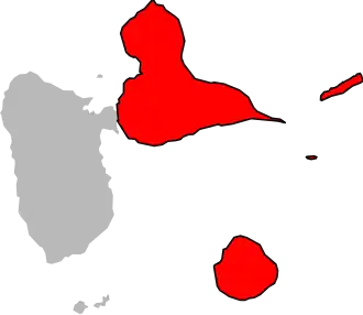
Arrondissement Pointe-à-Pitre (fr. Arrondissement de Pointe-à-Pitre) je správní územní jednotka nacházející se převážně na ostrově Grande-Terre v zámořském departementu a regionu Guadeloupe ve Francii. Člení se dále na 11 kantonů a 14 obcí.
Kantony
- Les Abymes-1
- Les Abymes-2
- Les Abymes-3
- La Gosier
- Morne-à-l'Eau-1
- Morne-à-l'Eau-2
- Le Moule
- Petit-Canal
- Pointe-à-Pitre
- Sainte-Anne
- Saint-François
Obce
- Anse-Bertrand
- Capesterre-de-Marie-Galante
- Grand-Bourg
- La Désirade
- Le Gosier
- Le Moule
- Les Abymes
- Morne-à-l'Eau
- Petit-Canal
- Pointe-à-Pitre
- Port-Louis
- Saint-François
- Saint-Louis
- Sainte-Anne
Portály: Francie