Arrondissement Oloron-Sainte-Marie
| Arrondissement Oloron-Sainte-Marie | |
|---|---|
| Geografie | |
| Hlavní město | Oloron-Sainte-Marie |
| Souřadnice | 43°11′ s. š., 0°37′ z. d. |
| Rozloha | 2 884,88 km² |
| Geodata (OSM) | OSM, WMF |
| Obyvatelstvo | |
| Počet obyvatel | 74 594 (2009) |
| Hustota zalidnění | 25,9 obyv./km² |
| Správa regionu | |
| Stát | |
| Region | Akvitánie |
| Departement | Pyrénées-Atlantiques |
| Druh celku | Arrondissement |
| Podřízené celky | Kantony: 12
Obce: 155 |
| Některá data mohou pocházet z datové položky. | |
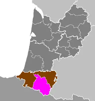
Arrondissement Oloron-Sainte-Marie (fr. Arrondissement de Oloron-Sainte-Marie) je správní územní jednotka ležící v departementu Pyrénées-Atlantiques a regionu Akvitánie ve Francii. Člení se dále na 12 kantonů a 155 obcí.
Kantony
- Accous
- Aramits
- Arudy
- Laruns
- Lasseube
- Mauléon-Licharre
- Monein
- Navarrenx
- Oloron-Sainte-Marie-Est
- Oloron-Sainte-Marie-Ouest
- Sauveterre-de-Béarn
- Tardets-Sorholus
Portály: Francie